Need a Place to Hike? Here are 9 Awesome Treks in Colorado
‘Need A Place to Hike?’ Series OVERVIEW
I get a lot of questions about travel recommendations. And I mean a lot. Loads of different people ask for tips on hiking, traveling abroad, about states in the US that I’ve spent only a handful of weeks in, but almost all the questions are the same:
What are your tips for backpacking? (Click the link to find out.) Where should I go in Colorado on a hiking trip? What should I see in Ireland if I only have a few days? And so it goes.
Well, this is my answer to one of those questions.
What you’ll find below is the first part of a series. While this article specifically covers Colorado, subsequent parts of the series will contain my recommendations for more hikes in other states and regions, as well as cities and landmarks you should visit in the US and abroad.
So if you’ve messaged me about suggestions and I’ve sent you this link, now you understand why. It’s just slightly more convenient for me.
Enjoy!

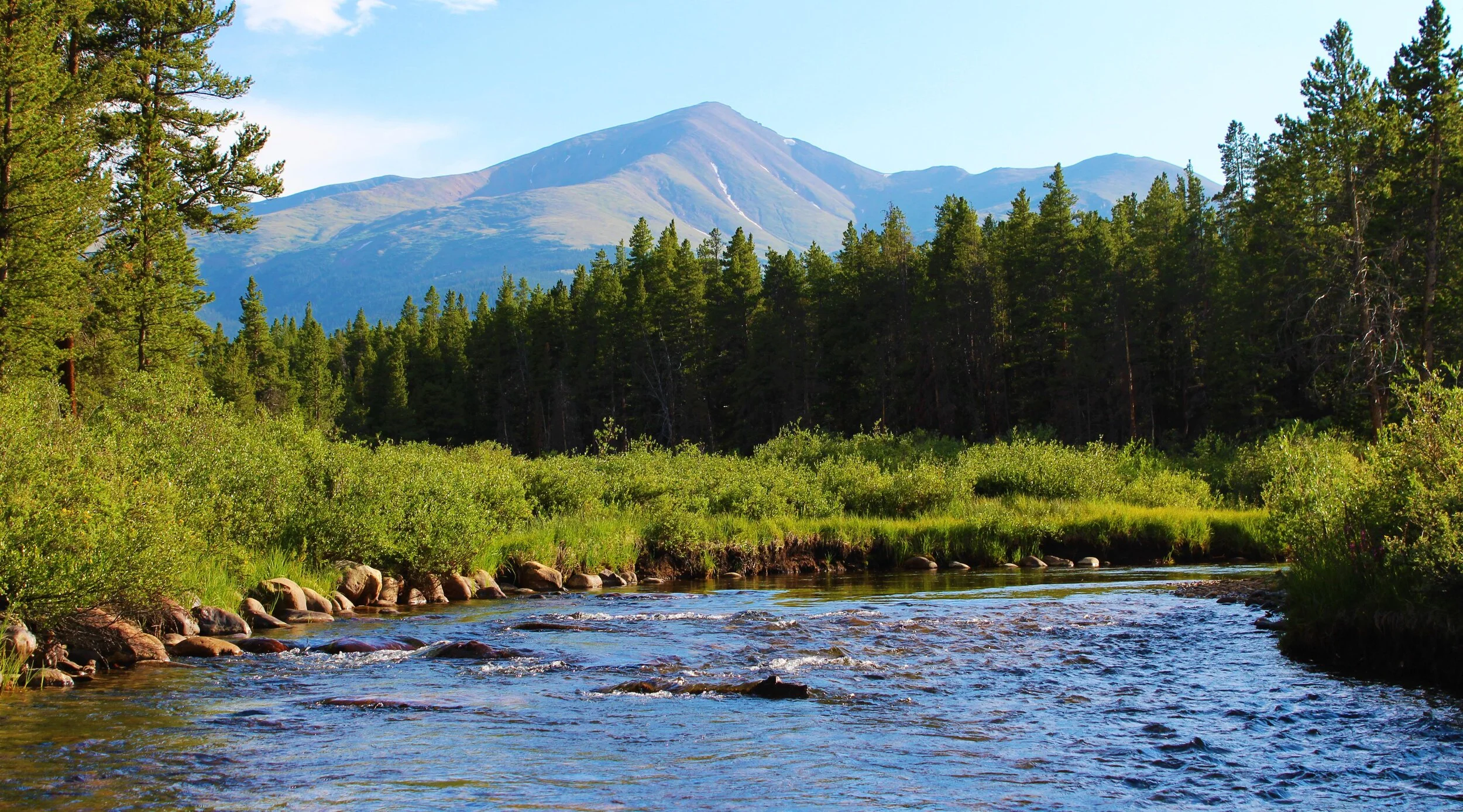
Continental Divide at Loveland Pass, Arapaho National Forest
TRAIL RATINGS & EXPERIENCE LEVELS EXPLAINED
INEXPERIENCED HIKER
An individual who does not regularly hike and hasn’t been on a hike more than a few miles.
EXPERIENCED HIKER
An individual who has completed longer hikes (greater than 10 miles in a day,) multiple-day hikes, or someone who hikes regularly.
DIFFICULTY - BEGINNER
Most inexperienced hikers could handle this.
DIFFICULTY - MODERATE
Inexperienced hikers should continue with caution after proper research. Experienced hikers should be fine.
DIFFICULTY - EXPERIENCED
Inexperienced hikers should avoid these until they feel absolutely ready to attempt them. Experienced hikers will be challenged in some way.
Important Note
Remember, these ratings are subjective. I made them up myself based on my experience. Additionally, you will notice that I reference AllTrails quite a bit; this is a great resource that has extensive information on each trail. You can click the blue-green hyperlinks throughout for more stats and photos!
9 AWESOME HIKING TRAILS IN COLORADO
BURRO TRAIL TO WINDY PEAK, GOLDEN GATE CANYON STATE PARK
DIFFICULTY
Moderate
DISTANCE + ELEVATION GAIN
STORY TIME
When I was hiking this wonderful little trail, I was unexpectedly halted by a large beast lying in my path. It had a hunched back with thick, brown fur, and it was clearly massive.
Although I could only see its back, I thought it could be a grizzly since I was in Colorado. The beast was only about 20 feet away and much too close for comfort. But when it suddenly stood up, it was a cow moose!
The moose stared at me, and I stared back. This contest lasted about 10 minutes until it started happily munching on tree branches, and I walked right past it, only a few yards from its hulking frame.
This trail is well-known for moose sightings; so if you’re looking for a true wildlife encounter, this is the spot!
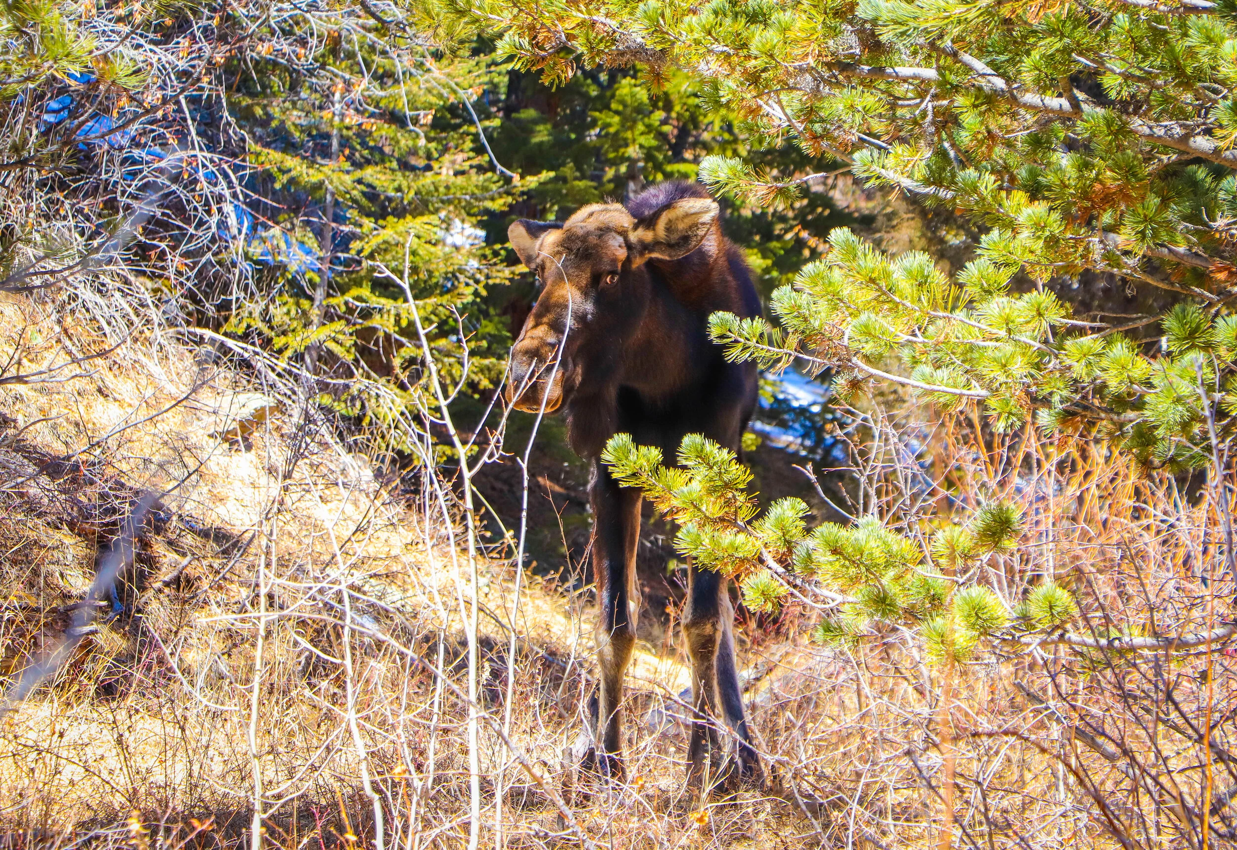
Moose on the Trail, Burro Trail to Windy Peak, Golden Gate Canyon State Park
DEVIL'S HEAD LOOKOUT TRAIL TO FIRE TOWER, PIKE NATIONAL FOREST
DIFFICULTY
Beginner
DISTANCE + ELEVATION GAIN
FUN FACT + DESCRIPTION
This trail is rated #1 of 221 hikes in Pike National Forest on AllTrails.com.
This trail is relatively easy, so it’s a great outing for beginners and families. That’s probably why it has such a high rating on AllTrails.
You drive most of the way up, but you hike the last mile or so (one way) to a lookout tower that will have a National Park Ranger scanning for fires. When I went almost 10 years ago, we were awarded a Squirrel Card for summiting. It was like a scout’s badge, a little accolade for completing the trek.
Who knows if they still hand out Squirrel Cards, but the view of Colorado from the top ebbs and flows for dozens of miles.
If you’re short on time in Colorado or looking for a little day-trip hike, this is not to be missed.
HIGH DUNE TRAIL, GREAT SAND DUNES NATIONAL PARK AND PRESERVE
DIFFICULTY
Beginner
DISTANCE + ELEVATION GAIN
FUN FACT + DESCRIPTION
This trail is rated #1 of 14 hikes in Great Sand Dunes National Park and Preserve on AllTrails.com.
This is a design-your-own-adventure kind of hike. And it’s absolutely wonderful. You can spot the top of the dunes from the visitor center, so it’s pretty clear where you’re meant to go.
It’s only about 700 feet of elevation gain, but it’s exhausting trudging through the sand. That doesn’t take away from the fun, though.
Jumping off the ridges of the dunes into the soft sand is magical. For a moment, you feel like you’re flying. You can also bring some type of sled to speed back down to the base of the massive sand hill.
Nothing is more impressive than the sheer oddness of it all. Why there is a giant sandbox in the middle of nowhere, not anywhere near the sea, is downright incredible. If you don’t know the history, it’s fun to wonder as you wander.
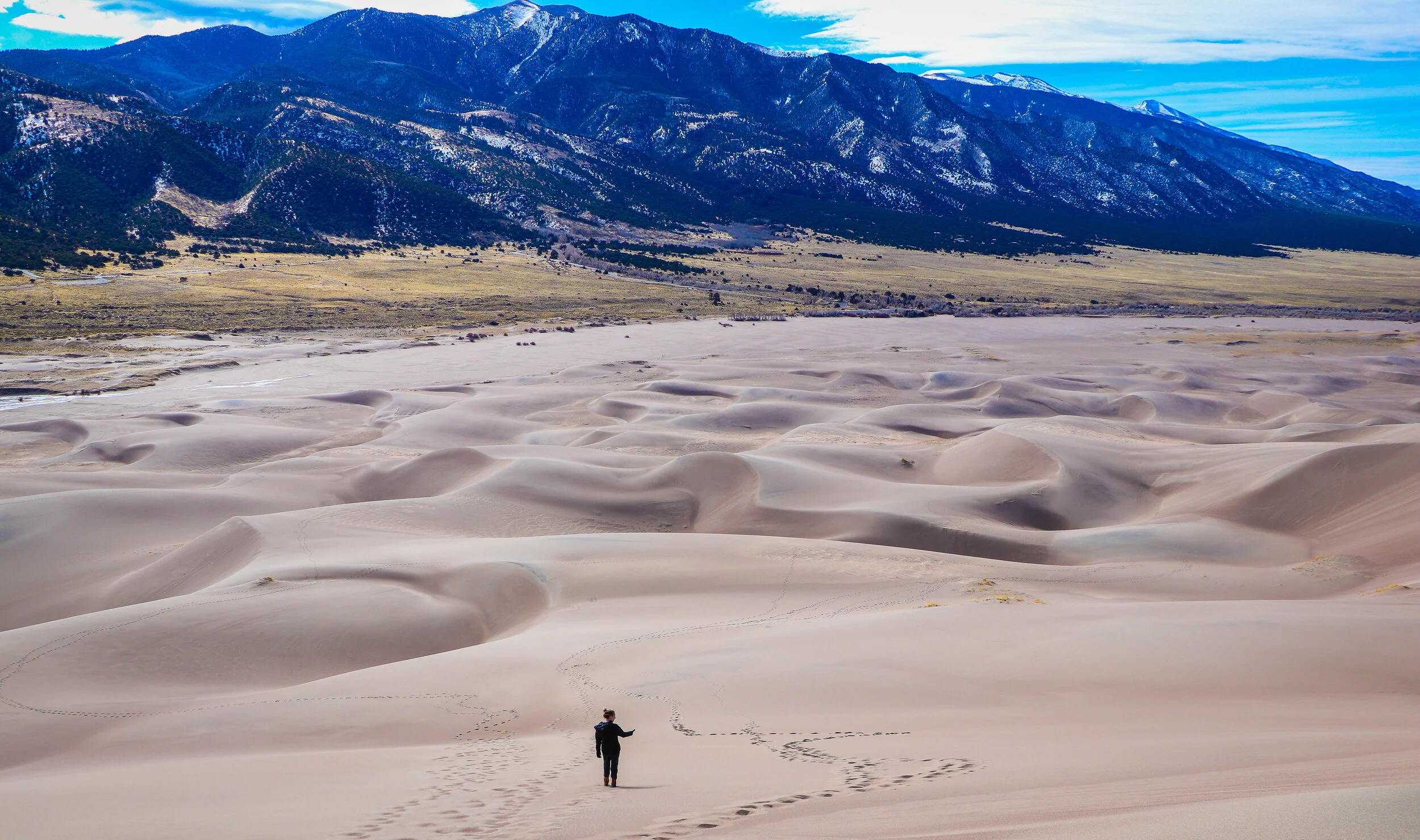
High Dune Trail, Great Sand Dunes National Park and Preserve
MOHAWK LAKES TRAIL, ARAPAHO NATIONAL FOREST
DIFFICULTY
Beginner to Moderate
DISTANCE + ELEVATION GAIN
DESCRIPTION
I’d rate this beginner to moderate because it’s not terribly long, but the elevation gain is enough to challenge inexperienced hikers. Nonetheless, when I did this hike in the summer, families with children and dogs were everywhere.
This is another hike that has a rewarding endpoint. There are two lakes at the top that feel like they just don’t belong there. That’s what makes them special. Mountain-top lakes are a lovely anomaly.
If you’re lucky, you can spot wild mountain goats. We saw a handful, and it was quite enjoyable to watch them graze on the mountainside.
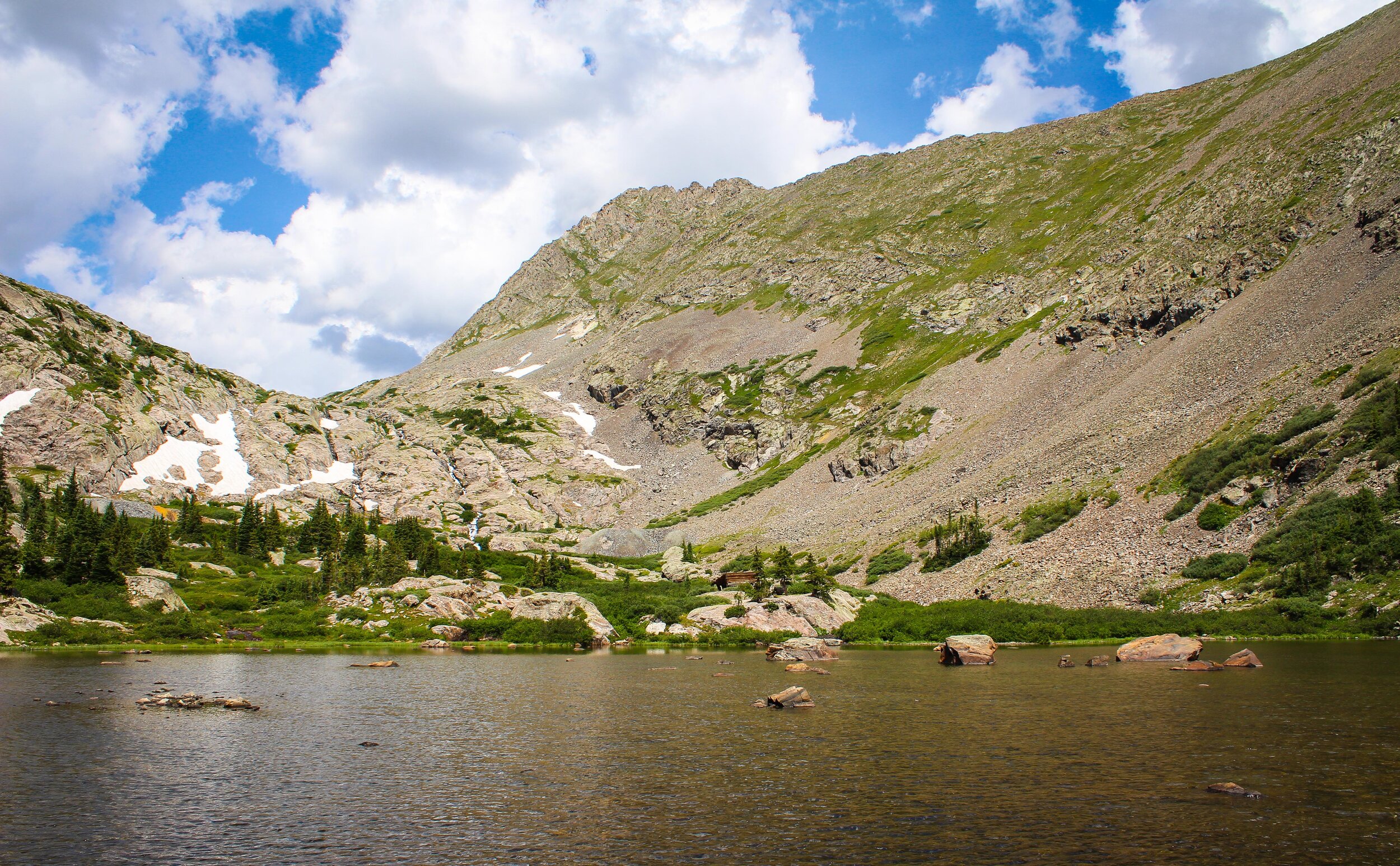
Mohawk Lakes Trail, Arapaho National Forest
MOUNT BIERSTADT TRAIL, MOUNT EVANS WILDERNESS
(INCOMPLETE: MADE IT TO ABOUT 13,000 FT.)
DIFFICULTY
Summer: Moderate to Experienced
Winter: Experienced
DISTANCE + ELEVATION GAIN
DESCRIPTION
Mount Bierstadt is a 14er. If you haven’t heard the term before, it’s a mountain that’s 14,000 feet or taller. I, very stupidly, attempted this in the heart of Colorado’s winter without the proper gear.
I made it to around 13,000 feet, then I was forced to turn back because of extremely deep snow and a blistering wind that cut right through my insufficient gloves and clothing. The few other hikers I met had crampons and oxygen masks. Their inhuman appearance made my mistakes obvious:
I wasn’t prepared.
I would highly recommend this trail and mountain, though. It’s a very popular hike because it’s doable in a day; it’s easier for a 14er; and it’s less than a hour-and-a-half drive from Denver.


MOUNT SNIKTAU TRAIL, CONTINENTAL DIVIDE AT LOVELAND PASS, ARAPAHO NATIONAL FOREST
DIFFICULTY
Beginner to Moderate
DISTANCE + ELEVATION GAIN
DESCRIPTION
If you like unbelievable views without any of the work, this is the trailhead for you! You can park right on the Continental Divide and witness the natural grandeur with almost zero effort.
For you avid hikers out there, you still have the option to follow a short trail. At just over three miles, the Mount Sniktau Trail offers an overlook of either side of the Continental Divide, a decent challenge, scrambling opportunities, and the chance to see mountain goats. What more could you ask for?
But we not only saw two mountain goats fighting on the edge of a snowy cliff, we also bumped into a couple marmots, which chirped wildly at our presence.

Mount Sniktau Trail, Continental Divide at Loveland Pass, Arapaho National Forest
NORTH MOUNT ELBERT TRAIL, SAN ISABEL NATIONAL FOREST
START LOCATION
Mt. Elbert Trailhead Parking Lot to N. Mt. Elbert Trail
DIFFICULTY
Experienced
DISTANCE + ELEVATION GAIN
FUN FACT + DESCRIPTION
Mount Elbert is the tallest mountain in Colorado. It is also the second tallest in the Continental US at 14,439 total feet.
If you’re dying to summit the tallest mountain in Colorado, this is one trail option that I’d advise. It can be surprisingly crowded in the summer months; if you desire more of a challenge and less people, there are other approaches.
You can park at the Mt. Elbert Trailhead Parking Lot and hike to the North Mt. Elbert Trail junction, which is about a mile away. You follow the North Trail to the summit, and that’s about 4,500 feet above you… nearly a vertical mile.
This is not for the faint of heart, but it is doable in a day for those who want it badly. If you’re experienced and in shape, you should be able to summit. Even if you’re not, it’s definitely possible.
I saw all sorts of people reach the peak. From the under-prepared who neglected carrying supplies to insane mountain runners, my team and I witnessed it all.
I would recommend starting very early, around 4:00 or 5:00 in the morning. Summit before noon and make noon your no-matter-what turn around time. Generally, you don’t want to stay on a peak later than 2:00 PM. Weather changes quickly on mountains, especially on ones of this size. People have died here because of ignorance and lack of mountaineering knowledge. Don’t attempt until you’ve done proper research.
Bring plenty of food and more than enough water. I suffered from altitude sickness and desperately needed to hydrate on the peak before I could move again, and I’d been hiking in Colorado for nine days prior… and I was in great shape.
If you leave early and with the right supplies, you’ll be fine. Oh, and you’ll love the view from the top. It’s stunning.
Mount Elbert, San Isabel National Forest
RED ROCKS TRADING POST TRAIL, RED ROCKS PARK & AMPHITHEATER
DIFFICULTY
Beginner
DISTANCE + ELEVATION GAIN
Description
This may not even be considered a true hike. It’s more of a stroll around a park on a well-groomed path, but that doesn’t take away from how wonderful it is.
Red Rocks Park & Amphitheater is a gorgeous and other-worldly place.
If you’re a music lover, you can hop off the trail and enjoy a show at the gorgeous amphitheater, which is surrounded by the strange and remarkable landscape of Red Rocks.
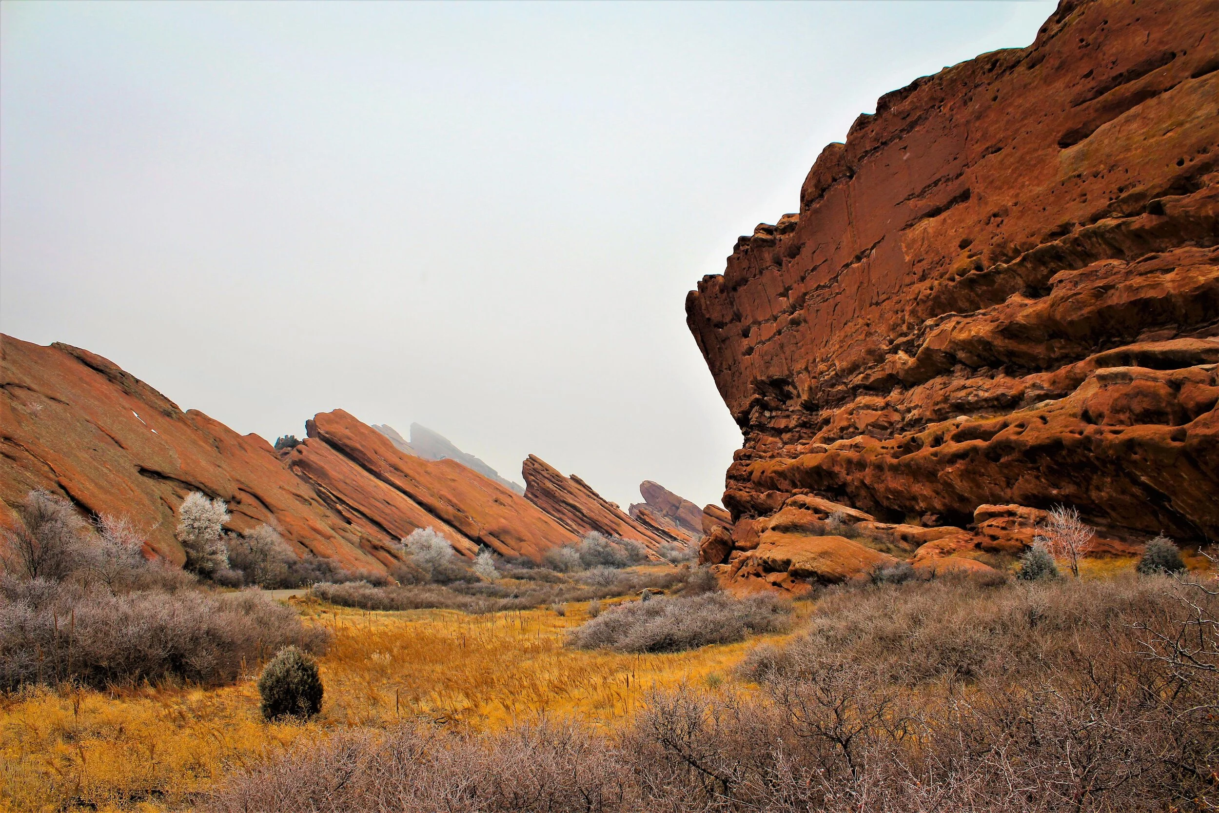
Red Rocks Trading Post Trail, Red Rocks Park & Amphitheater
TURTLE ROCK Campground, BUENA VISTA
DIFFICULTY
Hiking: Beginner
Climbing: Moderate to Experienced
Description
This is actually not a hike. Turtle Rock Campground is a free campground in Buena Vista. It also has a massive rock formation shaped like a turtle’s shell, hence the name. Additionally, it provides some great crag climbing, and you can learn more with the link in the title.
Buena Vista is one of my favorite spots to visit because the town itself is splendid. It’s a great little spot near some of the tallest mountains in Colorado, including Mount Elbert and Mount Massive. The people are kind; the shops are interesting; and the food is authentic.
Check out Buena Vista, Turtle Rock Campground, and then make your way to the Sawatch Range for some intense hiking!


Have any thoughts on this blog post? If so, let me know in the comments. I love feedback, so don’t hesitate to reach out!
If you really loved this article, make sure to like below and share it with others who will enjoy it as well.
Thanks for reading; keep an eye out for future blog posts; and happy reading! - Cullan